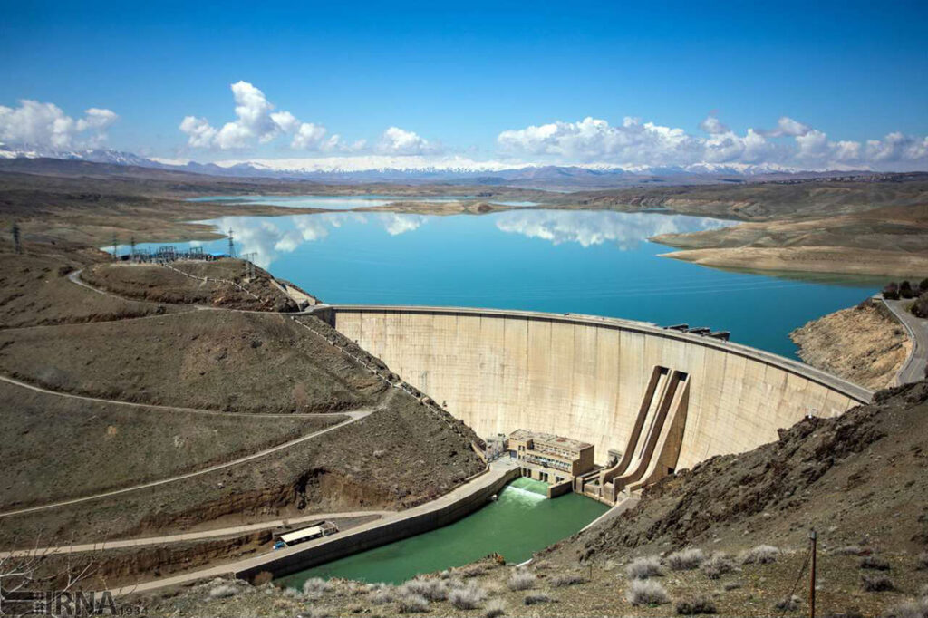
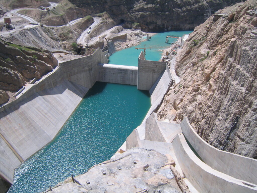
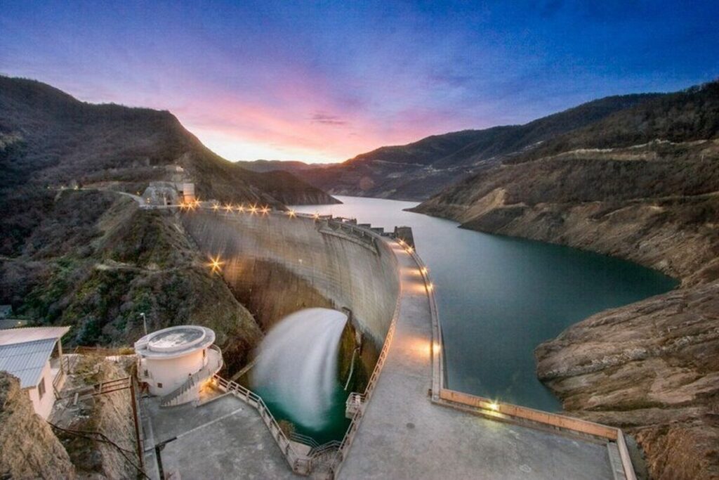
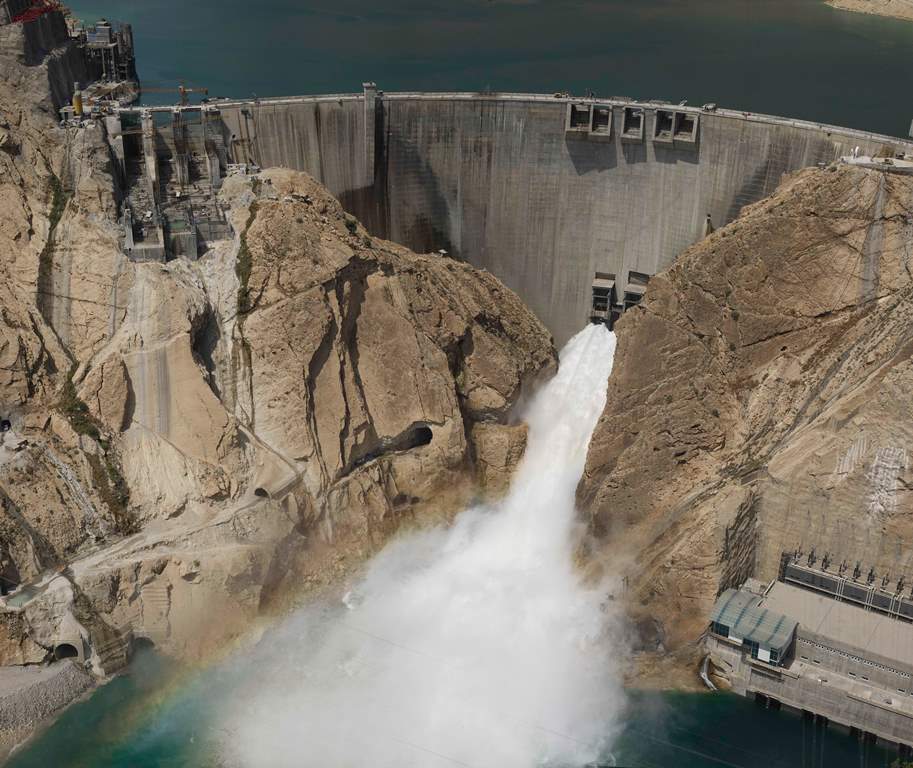
The Karun 4 Dam on the Karun River in southwestern Iran is a 230 m high, 400 m crest arch-gravity concrete dam, designed for hydroelectric power and flood control. Its 1.2 billion m³ reservoir and 6‑unit underground powerhouse (200 MW each) are supported by advanced geotechnical studies, rock anchoring, grouting, and Drill-and-Blast tunnels. Construction utilized diversion tunnels, cofferdams, phased concrete placement, and real-time instrumentation for structural, reservoir, and seismic monitoring. Karun 4 is a critical part of Iran’s energy grid while providing flood management and irrigation benefits.
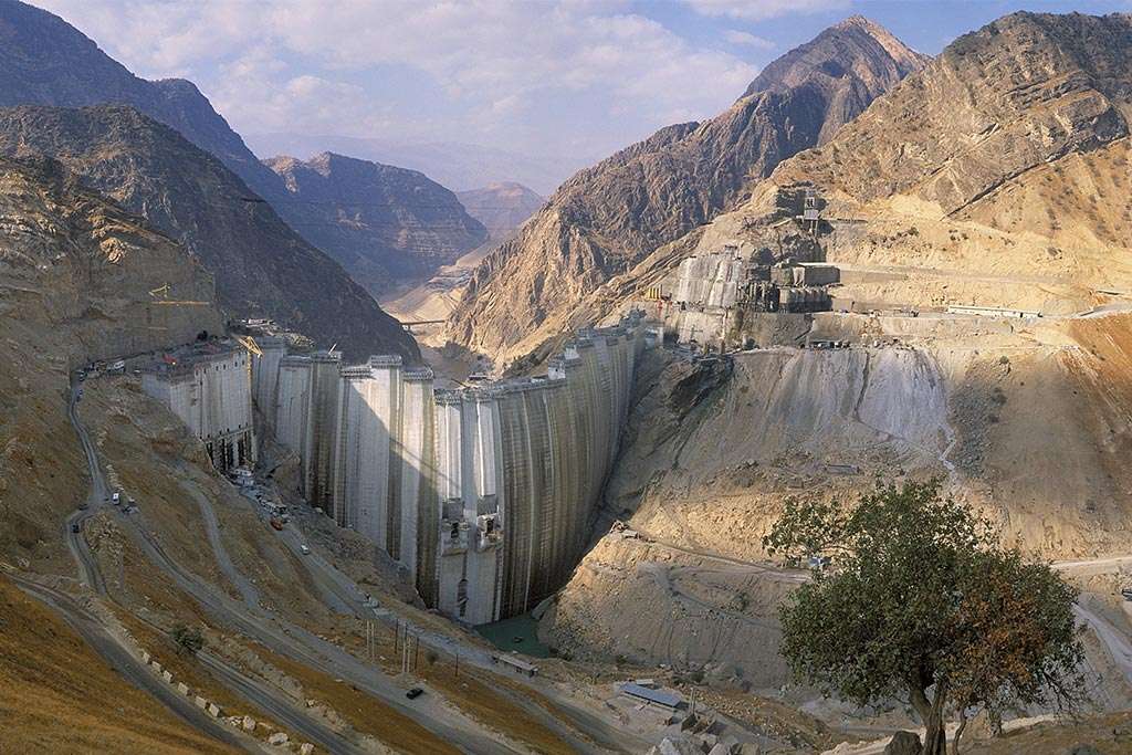
Dam Type & Size – Arch-gravity concrete dam, 230 m high with a 400 m crest.
Reservoir – 1.2 billion m³ capacity for power generation and flood control.
Powerhouse – Underground, equipped with 6 × 200 MW Francis turbines.
River Diversion – Tunnels and cofferdams designed for safe flow management.
Construction Methods – Drill & blast tunneling, rock anchoring, grouting, and phased concrete placement.
Monitoring & Benefits – Real-time instrumentation plus energy, flood control, and irrigation support.
Iran Water and Power Resources Development Co
Chaharmahal-Bakhtiari,
Iran
The Challenge
The Karun 4 Dam & Hydropower Project, located on the Karun River in southwestern Iran, presented major engineering and geological challenges. As a 230 m-high double-curvature arch dam, it required precise structural design to withstand high water pressure, variable seismic loads, and complex rock mass conditions. Excavation for the underground powerhouse and associated tunnels had to navigate fractured and weathered rock, karstic zones, and potential fault lines. Sediment management in the river, diversion during construction, and ensuring long-term reservoir stability under fluctuating flows added to the technical complexity. The combination of high hydraulic head, deep underground structures, and seismic activity demanded advanced geotechnical, structural, and hydrological design approaches.
What did RMTEC do
RMTEC delivered an integrated engineering approach combining detailed geotechnical investigations, 3D numerical modeling, and seismic risk analysis. Rock mechanics studies informed optimized excavation and lining design for tunnels, diversion channels, and the powerhouse cavern. Advanced structural design ensured the arch dam could safely handle high water pressures and dynamic seismic loads. RMTEC also developed sediment management strategies, diversion works, and operational guidelines for the reservoir, ensuring safe water flow during construction and long-term operation. Close coordination with contractors and stakeholders ensured that construction sequencing and safety protocols met international standards.
The Results
- Safe, high-capacity 1,000+ MW hydropower generation
- Robust dam design for seismic and hydraulic loads
- Efficient tunnel and powerhouse construction in complex geology
- Improved water management and regional development benefits